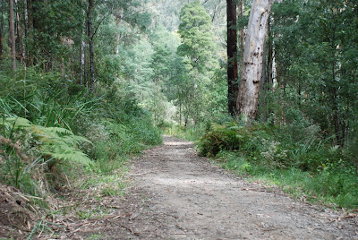
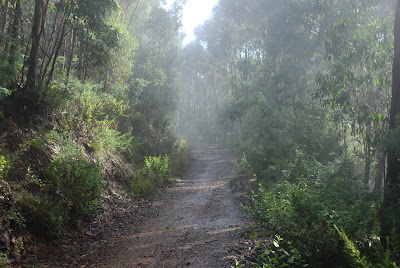
Five Walkabouters met at Millgrove on this glorious spring morning. Low clouds hung on the hills on the other side of the valley, obscuring the views towards Mt Donna Buang.
Millgrove is a small township just west of Warburton, nestled in the Yarra Valley 70 kilometers east of Melbourne. The highest peak in the area is Mt Donna Buang, which at 1249 meters, looms over Warburton and is regularly covered with snow during winter.
Millgrove is a small township just west of Warburton, nestled in the Yarra Valley 70 kilometers east of Melbourne. The highest peak in the area is Mt Donna Buang, which at 1249 meters, looms over Warburton and is regularly covered with snow during winter.
Today we planned to undertake a 10 kilometer circuit walk commencing opposite the sawmill in Millgrove, walking east to Stockmans Creek and then taking a steep goat track towards the summit of Mt Little Joe.
 |
| The historic saw mill at Millgrove |
After our morning cups of tea and coffee and gathering supplies from the local bakery, we set off in an easterly direction along the Warburton Rail Trail.
 |
| I wonder if there a ghost trains? |
The morning light shone through the newly grown leaves of the deciduous trees.
Not far along our path we bumped into another walking group, coincidentally doing the same walk but in the opposite direction.
 |
| Waterfall at the Dolly Grey Picnic Area |
Just before entering the township of Warburton, we took a track that headed south that was signposted ominously, 'The Backstairs'.
A slow and steady approach to walking was taken up 'The Backstairs'. And we were well rewarded.
Our quietness enabled us to come upon a pair of lyrebirds scratching for food in the undergrowth. As we approached them, they were finally alert to our presence and dashed into the bush. One crossed the track and went over a bubbling creek and after a few moments, it recommenced searching for worms and insects. The lyrebird must have felt comfortable with us watching, as it started singing away. Not quite sure which bird it was imitating but it sounded suspiciously like a chicken!
(There are no photos of the lyrebirds as it was so dark and would have been lost in all the detail of the bush undergrowth - well that's my story and I am sticking to it.)
We made it to the top of the climb and enjoyed a well earned morning tea.
 |
| Grey walking track |
Our energy replenished, we continued along the trail in the shadow of Mount Little Joe.
 |
| Red walking track |
The views of the valley below were quite elusive between the trees.
We had lunch on the hillside,
before making our descent into the green valley.
 |
| Our outdoor cafe. |
Following the trail downhill, we crossed the road,
 |
| Mount Donna Buang in the distance. |
and rejoined the rail trail.
 |
| Mount Little Joe |
Looking across the pasture, we could see where we had just been walking.
Ambling slowly along, chatting and enjoying each others company,
it wasn't long before we arrived back to Millgrove.
We enjoyed cups of tea and biscuits sitting on the back of our cars in the afternoon sunlight.
Here is some artwork of what the local's think about living in...
 |
| A very convenient place. |
It is certainly a great area to enjoy walking, fresh air and the Australian bush.
We walked about 10.3 kilometers and climbed almost 510 meters....maybe we'll make it to the top of Mt Little Joe next time or even Mt Donna Buang.
We walked about 10.3 kilometers and climbed almost 510 meters....maybe we'll make it to the top of Mt Little Joe next time or even Mt Donna Buang.
Walkabouters Club of Victoria Inc.
A0019863A


