Showing posts with label Notice this Notice. Show all posts

Wednesday, October 16, 2013

Walk Notice: Tanglefoot Track, Toolangi - Sunday 20th, October

The Walk:

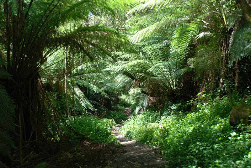
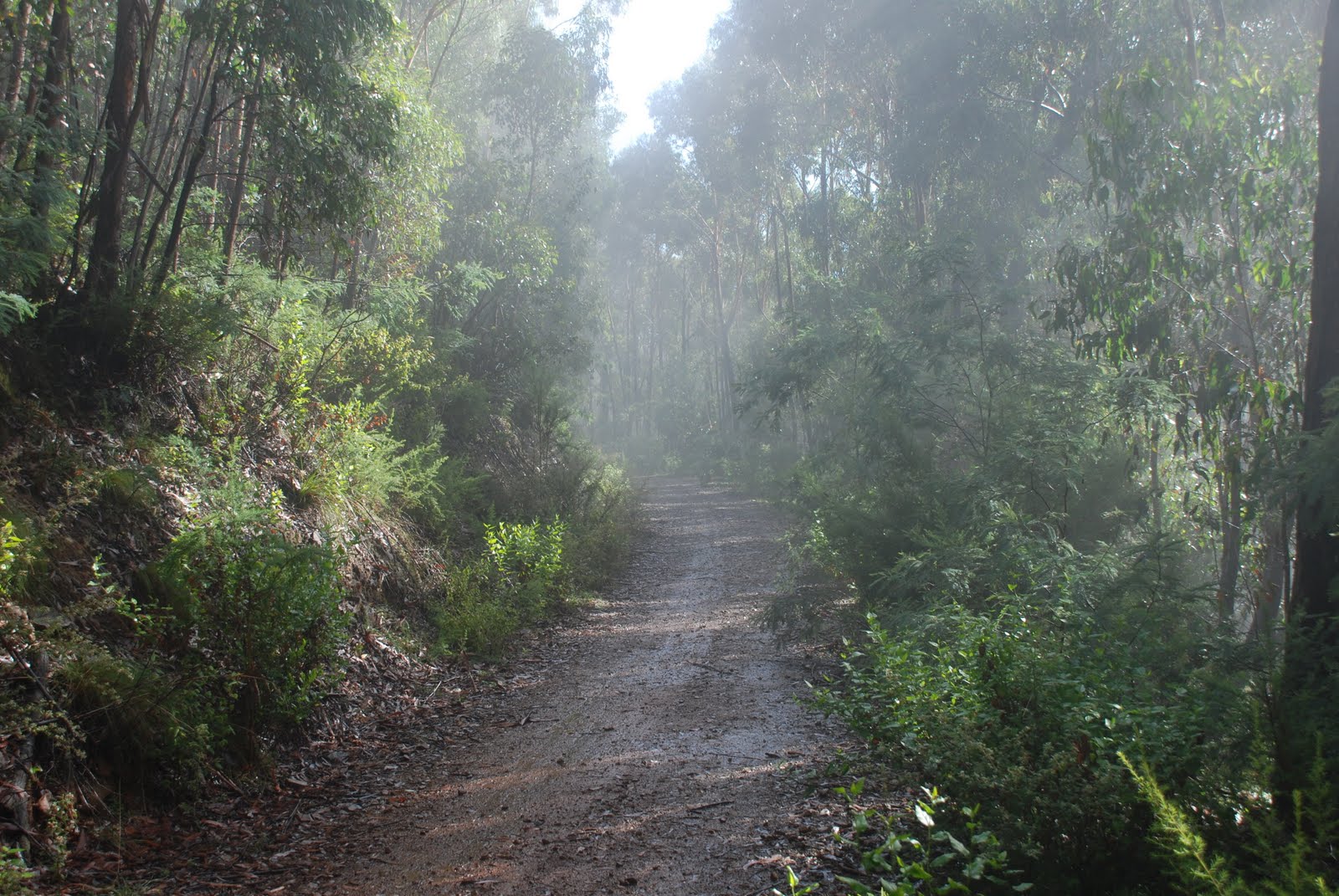
A beautiful walk through towering Mountain Ash trees and archers of tree ferns. From Tanglefoot car park, we start walking on the Tanglefoot walking track which includes sections of boardwork and footbridges. The track skirts the western slopes of Mount Tanglefoot until it joins the Quary walking track. This track gently climbs 150 meters towards Mount St Leonard and then an equally gentle descent of 300 meters to wards Wirrawilla car park.

The Grade:

Medium walking, about 15 km in length.


Some photos to whet your walking appetite!!


For further information regarding this walk
contact: walkabouter@hotmail.com


Walkabouters Club of Victoria Inc.
A0019863A


Thursday, June 13, 2013

WALK NOTICE: Murrindindi River Walk, Murrindindi Scenic Reserve, Sunday 16th of June.


The Walk:

We will commence our walk following the stepped track at the Cascades where the river drops steeply over granite boulders. This walk follows the Murrindindi River downstream. The walk crosses over five footbridges and offers river views through a variety of forest types from tall open forest to damp ferny gullies.

A car shuffle will return us to the Cascade Picnic Area.

Grade:

Moderate walking 10 kms on formed tracks with some short steep bits and some steps.

Plus an Optional side trip to Wilhemina Falls, 4kms return on a formed steep track with many steps.


Where is Murrindindi? I hear you cry!! 

Well if you would like to join us for a leisurely walk you will find out!


For more details contact:
walkabouters@hotmail.com


The skies are looking very grey this winter so make sure you pack a rain coat!!


Walkabouters Club of Victoria Inc.
A0019863A


Friday, May 17, 2013

WALK NOTICE: TRENTHAM DOMINO TRAIL - Saturday 18th May


Background

Trentham station is a closed railway station in the town of Trentham, on the former Carlsruhe-to-Daylesford line. It opened on Monday, 16 February 1880, and was closed July 1978. The station building, platform and goods shed, and a short section of track, have all been retained, although no train services currently operate from the station. Tenants live at the station and look after it as a museum. most of the line's track has been removed, the land is still zoned for railway use, and track still exists for 1 km on either side of the station. Some rolling stock is still kept in the former yard. 

The Walk


This is a delightful meander seeing some of the history and flora of the area.For the first 500m, the rails are still in place and the grass- covered trail runs between them. On the left can be seen the old Sunnyside foundry. 
  • After Falls Rd, the trail enters bushland. Species of eucalypt include manna gum, peppermint and mountain gum. A kilometre on, it leaves the rail formation to skirt private property.
  • After passing through lower lying areas dominated by swamp gum, the trail returns to the formation at Doctors Creek.
  • Along this section, watch for swamp wallabies, grey kangaroos and short-beaked echidnas.
  • The principal marked trail ends on a high railway embankment. A short loop trail has been constructed here which takes you down to the Domino Creek to see the brick-lined tunnel that carries the creek under the line. The loop continues along an old logging trail before returning to the railway. 

    This trail uses the Powerful Owl as its trail symbol. This is an species occasionally seen in this area. Sign boards along the trail explain the history of the area.

The Grade 

Easy walk, 10 km mostly flat with a couple of gentle undulations. 


Here is a photo that was not taken in Trentham.

Faerie's aprons with West Pelion


 The Overland Track in Tasmania is a must for any bushwalker!


Walking the Domino Trail in Trentham is a must for all Walkabouter's this Saturday!

See you there or be square!!


For more information contact:

walkabouters@hotmail.com


Walkabouters Club of Victoria Inc.
A0019863A


Friday, April 26, 2013

Walk Notice - George Bass Coastal Trail - Sunday 28th April

This Sunday the Walkabouters will be wandering along the George Bass Coastal Trail.


The Walk:

This is a walk along the cliff-tops from near San Remo to Kilcunda, and back again, with views out to Bass Strait. The path is undulating as it passes through coastal shrubs and over grasslands. We will also remember George Bass and his voyages here over 200 hundred years ago. 

Grade:

Medium walking, about 14 km in length. 


Here are some coastal views to whet your appetite!


Except that the photos wont upload!


Oh, here they are.

Sleepy Bay, Freycinet Peninsula, Tas.


Winegalss Bay, Freycinet Peninsula, Tas.


The Hazards, Freycinet Peninsula, Tas.


The views along the cliff tops from the Goerge Bass Coastal Trail
may be just as beautiful.


Looking forward to seeing you there.


For more information contact:
walkabouters@hotmail.com


Walkabouters Club of Victoria Inc.
A0019863A


Tuesday, April 2, 2013

Walk Notice - Sherbrooke Forest Walk – Dandenong Ranges National Park – Saturday 6th April


Mount Ossa is the highest peak in Tasmania and can be reached via the Overland Track.


Our walk this Saturday will be through part of the Dandenongs Ranges.


Sherbrook Forest to be exact!


Here are some details of what to expect on the walk.


The Walk:            

We will follow tracks through the heart of Lyrebird Habitat in the Sherbrooke Forest. The tracks will take us through stands of tall Mountain Ash, tree fern gullies and past water falls. There will be a couple of gradual, steep climbs, which we will take very gradually. The tracks are wide and firm under foot. On the second climb the track is a bit narrower, not rocky but has some exposed tree roots. There will be plenty of resting opportunities after the climbs and the chance of seeing lyrebirds, kangaroos and wallabies.


Grade:              

Moderate, 11-12 kms


And you never know,


 we may stumble across the TARDIS and hitch a lift to the top of Mount Ossa,


to enjoy the views.


Looking forward to seeing you there.


To join us on this walk, contact walkabouters@hotmail.com


Walkabouters Club of Victoria Inc.
A0019863A


Sunday, September 30, 2012

Walk Notice - Cranbourne Botanic Gardens - Saturday 6th October

Walk:

This venue had been chosen to enable all Walkabouters to take part.
Some can start by exploring part of the untouched heathy woodland 
and wetland of the 363 hectare site and climb to Trig Point Lookout 
for a 360 degree view.

The diverse remnant bushland represents a rare glimpse of the type of vegetation 
that once covered much of Western Port and Port Phillip Bay regions.
After exploring the Australian Garden and Visitors Centre we will return to 
the Stringybark Picnic Area.

Others might like to just meet us at the Australian Garden.

Grade:

Easy walking


No, this is not a beach walk. Although, there will be red sand and water
and lots of native flora and fauna.


Looking forward to seeing you there!


To join us on this walk, contact walkabouters@hotmail.com


Walkabouters Club of Victoria Inc.
A0019863A


Sunday, September 9, 2012

Walk Notice - Richards Tramline - Sunday 16 September

Walk:

Richard’s tramline was built in the early 1920s to transport timber down to the sawmills. We will follow the tramline up from the Big Pats Creek Picnic Area, passing "The Curves", a series of bends, cuttings and embankments which carried the tramline into the Big Pats Creek valley. We will then continue along the tramline up the Mississippi Creek valley, through tall mountain ash forests, and, after lunch, return to the picnic area.

Grade:


Medium walking on an old tramway, about 12 km in length, with options for shorter walks.


Bunyips aren't the only things that can be found in the Australian bush.

Tramlines also appear out of nowhere! 


Richard had a strange sense of humour!


Looking forward to seeing you there.

Don't forget your gumboots!


For information about the Walkabouters,
contact walkabouters@hotmail.com


Walkabouters Club of Victoria Inc.
A0019863A

Sunday, August 19, 2012

Andrews Hill, Kinglake - Sunday 26 August


The Walk:

We will return here to see the how the area has recovered from the Feb 2009 fires. The walk is a loop from the picnic area, downstream along the creek for about 2km, a climb to the top of the hill and then it is downhill all the way back to the cars. The area is good for wildflowers and has many tall trees. The picnic area at Island Creek has been rebuilt with new toilets, signboard, paths and fences.

Grade:

This is a walk of about 11km on paths and tracks, with a moderately step section as it climbs 320 metres to the summit of the hill. For those not wishing to do the complete loop, there is the possibility of short walks from the meeting place.


Walking in Winter!


It's Saturday. No, it's Sunday. No, it's Saturday. NO! It's Sunday!! 
I will double check. Okay, yes, it's Sunday.

See you all on SUNDAY the 26th of August for a walk up Andrews Hill.

Hopefully it wont be too muddy!!


 For more information about the walk please email
 walkabouters@hotmail.com


Sunday, July 29, 2012

Boar Gully, Brisbane Ranges - Saturday 4th, August


The Walk:

We will walk in the Boar Gully area, in the northern section of the Brisbane Ranges National Park.

Grade:

Medium walking, about 12 km in length.

This rating means we won't be walking too fast, nor walking too slow. The tracks will well formed and underfoot. We will not be in peril, yellow or otherwise.


Yellow Peril??

What is the real name to this infamous Victorian sculpture?
And who was the Sculptor?

For the answers to these and many other mind boggling questions,
join us on our walk through Boar Gully in the Brisbane Ranges.


walkabouters@hotmail.com


Walkabouters Club of Victoria Inc.
A0019863A


Sunday, July 8, 2012

Walk Notice - Lerderderg Gorge - Sunday 15th July


The Walk:

One of Lerderderg’s oldest and most popular walks, East Walk follows the eastern bank of the river south of O’ Briens Crossing. Lerderderg’s rich gold mining past is on display and there are excellent views of the river along the way.

We have the option to complete a circuit following the water races and foot trails along the river before ascending Cowan Track to the top of the gorge. Due to recent floods, there is tree debris along the trail which we need to navigate around and over. The trail is undulating, narrow and uneven – so if you use poles it would be good to bring them.

It is also possible to complete a shorter section of the East Walk and return to O’Briens Crossing which is very picturesque. A perfect spot for painting or enjoying a brew.

Grade:

Moderate walking, between 10 - 14 km


Mount Wellington in Tasmania is nowhere near Lerderderg Gorge.

So we will be visiting Lerderderg Gorge as it is in Victoria!


For more information about the walk or if you would like to join us,
send an email to walkabouters@hotmail.com


Walkabouters Club of Victoria Inc.
A0019863A


Tuesday, June 19, 2012

Walk Notice - Silvan Reservoir- Saturday 23rd June


The Walk

We will walk along various tracks that meander through the forest that surround Silvan Reservoir. Initially, we may follow the Olinda Creek through fern gullies before crossing it to walk under tall stands Mountain Ash that grow on the eastern slopes of the Dandenong Ranges. We will then join tracks that will take us into the heart of the forest and onto the slopes of the dam. Lunch is planned for Eagles Nest Picnic ground. The track may then ascend to higher peaks closer to the waters edge before returning to the Sivan Picnic Grounds.

Grade:

Medium walking with various undulations and some steeper sections. The pace will be easy going and the track good under foot although it will be muddy and slippery if there is any recent rainfall. The distance will be about 10-12 kms.


Melbourne's Winter has well and truly set in!

Chase the Winter blues away, come along and enjoy a winter's walk 
through the forests of Silvan Reservoir. 

Remember to pack your rain coat and some salt!

To join us on the walk contact walkabouters@hotmail.com for more details.


Walkabouters Club of Victoria Inc.
A0019863A

Tuesday, May 29, 2012

Walk Notice - Mount Macedon, Sunday 3rd, June


Grade:

Easy/moderate walking, approximately 10 km


The Walk:

This walk explores the eastern parts of the Macedon Ranges walking track. Starting at McGregors picnic ground we follow the Macedon Ranges walking track to circuit the Camels Hump, visit various picnic areas and the picturesque Sanatorium Lake. From the lake, we follow the Zig Zag track to the Moola track which takes us through an uphill section of dense wet sclerophyll forest. This section is prolific with ground and tree ferns and green moss covered logs. After a short section of gravel road we return to our starting point with opportunity to enjoy a cuppa or the view from Camels Hump.


 Elephants?!


There will be no elephants on the walk but there will be a camel's hump!


For more information about the walk, please contact

walkabouters@hotmail.com


Me thinks that the moment my legs begin to move, my thoughts begin to flow.  
~Henry David Thoreau


Walkabouters Club of Victoria Inc.
A0019863A

Monday, May 7, 2012

Walk Notice - Mt. Martha Circuit - Saturday, May 12, 2012

                      
The Walk:

From Mt. Martha Park, we work our way down to sea level, following the Sunshine Creek. We then continue along tracks and secondary roads to the Balcombe Estuary Picnic Ground for lunch. After lunch, we commence the return, gradually upwards, via reserves, unmade roads and a golf course.

Grade:           Medium 12 km.

 Here is a picture to get you excited!


Is that Mt Martha I hear you cry? Well, no it's not.

This is Mt Ligbird on the left and Mt Gower on the right.

But don't be disapointed!!

Our walk in Mt Martha will be full of it's own intrigue and adventure.


To walk with us, email walkabouters@hotmail.com

You will be most welcome!


Walkabouters Club of Victoria Inc.
A0019863A


Monday, April 9, 2012

Walk Notice - Sassafras to Butterfiled Conservation Reserve, Sunday 15th April.

The Walk:

Walking along the Dandenong Ranges Tourist Track, we will follow the meandering paths of the Sassafras, Woori Yallock and Menzies Creeks.

We will walk through fern gullies and over ridges covered with stands of tall Eucalypts. The track will cross over bridges and boardwalks as well as a couple of main roads.

In places, the path is very narrow and nearly overgrown with grasses, so please wear long pants and shirt-sleeves to prevent scratches. The path may also be muddy in places and also prone to exposed tree roots.

The walk will commence from Sassafras and has been designed so it will be mostly downhill. The steep, up hill sections are avoided but there will be some undulations. There will be several picnic grounds along the way that may allow for a shorter walk for those who may be interested. Lunch will be at Baynes Reserve in Monbulk before continuing on to Butterfield Conservation Reserve near Emerald.


The Grade:

Moderate walking, 11 kilometres and car shuttle provided.


A walk through the heart of the Dandenongs!  


For more information contact us at walkabouters@hotmail.com


Walkabouters Club of Victoria Inc.
A0019863A

Friday, March 23, 2012

Walk Notice - Healesville - Saturday 24th, March

The Walk:

The Journey is easy to very social, this trip is open to all with many options. You can meet us at the Beechworth Bakery and at the farmers market and Badger’s Weir for a late lunch and bbq or come with us on a beautiful tour of the Healesville hills stopping at all locations and a walk at Badgers Weir after the walk. The distances are Healesville 4.5 k Badgers Weir 2.5k.

Grade:

Easy Walking, about 7 km in length.


 What's a pile of rocks got to do with walking in Healesville? And where is this pile of rocks?  
For answers these questions, why not join us for the wandering tour of Healesville.


Walkabouters Club of Victoria Inc.
A0019863A

Saturday, March 3, 2012

Walk Notice - Patterson River - Sunday 4 March

The Walk:

We will explore the trails and bike paths in the Edithvale area, as we walk a loop which will take in the banks of Patterson River, Eel Race Creek and the beach.

Grade:

Easy flat walking, about 14 kms in length.


Daly River in the Northern Territory is not the place to go swimming as there are far too many crocodiles!

Fortunately, Patterson River is free of crocodiles, so it's just right for a swim, 
well at least a walk anyway.

Looking forward to seeing you along the banks of Patterson River.


Walkabouters Club of Victoria Inc.
A0019863A

Wednesday, November 16, 2011

Walk Notice - Bushranges Bay - Sunday 20, November.

The Walk:

A walk along Main Creek to Bushrangers Bay and then along the cliff tops to Cape Schanck. Return the same way.


Grade:

Medium, about 12km in total.


Did someone say "Lighthouse"?!

Yes, there is a Lighthouse at Cape Schanck.

"But is it a 'real' Lighthouse", I hear you cry.

Well, join us on this walk and we may find out.

Here are some pictures of lighthouses to whet your appetite.


Cape Jervis lighthouse...or is it a beacon?


Cape du Couedic lighthouse.


Cape Borda lighthouse. Now there's a 'real' lighthouse!


Kingston SE lighthouse...on stilts but out of commission.


Beachport lighthouse, dwarfed by Norfolk Island pines.


And of course there will be lots of walking on cliff tops with ocean views!


Hope to see you there!


Walkabouters Club of Victoria Inc.
A0019863A

Saturday, October 22, 2011

Walk Notice - Werribee Gorge - Sunday 30th October

Grade:

Medium walking with a few uphills and downhills, about 14 km.


The Walk:

We will explore the Werribee Gorge State Park and see some of the Walkabouters old walking areas, as we remember Jack Myers. We may even hear a rabbit joke or two as we learn of the geology and history of the area. Our route will depend on the river height.


There are no Sea Lions in Werribee Gorge...


but there is a Lion Rock. 


Come join us on this walk to see this geological phenomenon and other natural delights in the Werribee Gorge.


Walkabouters Club of Victoria Inc.
A0019863A


Tuesday, October 4, 2011

Walk Notice - Main Yarra Trail - Saturday 8th of October

Grade:

Easy walking along a sealed trail, about 13km.


The Walk:

We will commence our walk at Finns Reserve and cross the Yarra to join the Main Yarra Trail. Heading upstream we will follow the trail through Westerfolds Park and Candlebark Park to our lunch spot. We will return by a similar route.


The Yarra Valley Parkland is a vital wildlife corridor and echidnas, robins, koalas and kangaroos may be spotted along the trail.


Is that river upside down?


Looking forward to seeing you on the walk!


If you would like more information about the walk,
please send an email to the address provided on the side.


Walkabouters Club of Victoria Inc.
A0019863A

Sunday, September 11, 2011

Walk Notice - Warburton Walk - Sunday 18th September

Grade:

Medium walking on mostly wide flat paths (Warburton Rail Trail) with one long steep uphill and moderate descent. In total about 10 -12 kms. There is an option for an easy short walk that is completely flat and that may include a coffee stop for those who are interested.

Contrary to the information in the newsletter, this walk is not one long 10-12 kilometer uphill climb. There are no mountains that are 10 kilometers high in Warburton or anywhere else for that matter. Sorry to disappoint!

The Walk:

We will follow the Warburton Trail towards Warburton. Before we enter the township, we will take the path leading to the Backstairs. The trail follows the Oxfam trail walk from a couple of years ago, across the side of a mountain before heading downhill and rejoining the Warburton trail to return to our starting point. There should be flowering native plants in abundance and even some black cockatoos and wallabies along our trail.


The mountain trail earlier in the year.


Looking forward to seeing you on the walk!


If you would like more information about the walk,
please send an email to the address provided on the side.


Walkabouters Club of Victoria Inc.
A0019863A


Related Posts Plugin for WordPress, Blogger...