Tuesday, May 29, 2012

Walk Notice - Mount Macedon, Sunday 3rd, June


Grade:

Easy/moderate walking, approximately 10 km


The Walk:

This walk explores the eastern parts of the Macedon Ranges walking track. Starting at McGregors picnic ground we follow the Macedon Ranges walking track to circuit the Camels Hump, visit various picnic areas and the picturesque Sanatorium Lake. From the lake, we follow the Zig Zag track to the Moola track which takes us through an uphill section of dense wet sclerophyll forest. This section is prolific with ground and tree ferns and green moss covered logs. After a short section of gravel road we return to our starting point with opportunity to enjoy a cuppa or the view from Camels Hump.


 Elephants?!


There will be no elephants on the walk but there will be a camel's hump!


For more information about the walk, please contact

walkabouters@hotmail.com


Me thinks that the moment my legs begin to move, my thoughts begin to flow.  
~Henry David Thoreau


Walkabouters Club of Victoria Inc.
A0019863A

Saturday, May 12, 2012

Mount Martha Ciruit - Saturday, 12th May


What a wonderful blustery day it turned out to be!

With the weather forecast threatening rain, rail and strong winds, seven Walkabouters met at Mount Martha Park for a circuitous walk through the park lands, bush and along waterways of Mount Martha.


Mount Martha is a coastal township located 60 kilometers south-east of Melbourne, on the south-eastern shore of Port Phillip Bay. The peak of Mount Martha was named after Martha Lonsdale, the wife of colonist William Lonsdale who supervised the founding of the settlement of Port Phillip in the 1830's.


We followed the road leading out of the park and crossed over and entered a local paddock with an unlocked gate.


A foot-pad lead us through the paddock and remnant bushland,


although there was a good layer of blackberries in the undergrowth.


We soon came upon Sunshine Creek and we followed the track down towards where it flows into Port Phillip Bay.


 We passed flowering native trees and plants,


and local resident's backyards!


The indigenous flora and fauna has been squeezed into small pockets of bushland


 that line creeks, ravines and estuaries that prove to be too difficult to clear and build residential housing.


 We caught glimpses of the Bay and weaved our way through the lane ways


  that divided residences and linked various parks and reserves.


Arriving at our lunchtime, 
we were met by some local fishery management personnel,


and some very welcome friends!


We enjoyed our lunch and chatting and catching up on news with dear friends.


The Belcombe Estuary provided some great views.


We left our luncheon spot behind,


and walked along the track that follows the estuary inland for a short distance.


A group photo opportunity presented itself,


 as the our paths soon took us different directions.


Say cheese!

The track and board walk, that have been constructed in the Belcombe and Ferrero Reserve, provided a leisurely stroll for our short distance walkers.


The walkers who chose to the longer route, followed the path up hill,


through reserves and along residential streets


and even through the local golf course.

We soon made it back to Mount Martha Park. 

After a brief rest and discovering some extra energy in our legs,
four Walkabouters set off on the challenging treck to the Summit of Mount Martha.

With almost all of our reserves exhausted we made it to top of Mount Martha. 

Another Victorian Peak in the bag!!


Here we are!


Just don't tell anyone that the summit of Mount Martha is only 166 ms above sea level!


To all our friends who weren't able to make the walk today, we look forward to walking with you on our next walk.


Walkabouters Club of Victoria Inc.
A0019863A


Monday, May 7, 2012

Walk Notice - Mt. Martha Circuit - Saturday, May 12, 2012

                      
The Walk:

From Mt. Martha Park, we work our way down to sea level, following the Sunshine Creek. We then continue along tracks and secondary roads to the Balcombe Estuary Picnic Ground for lunch. After lunch, we commence the return, gradually upwards, via reserves, unmade roads and a golf course.

Grade:           Medium 12 km.

 Here is a picture to get you excited!


Is that Mt Martha I hear you cry? Well, no it's not.

This is Mt Ligbird on the left and Mt Gower on the right.

But don't be disapointed!!

Our walk in Mt Martha will be full of it's own intrigue and adventure.


To walk with us, email walkabouters@hotmail.com

You will be most welcome!


Walkabouters Club of Victoria Inc.
A0019863A


Sunday, April 15, 2012

Sassafras to Butterfield Conservation Reserve, Sunday 15th April.

Today we walked along the Dandenong Ranges Tourist Track from Sassafras to Butterfield Conservation Reserve, near Emerald.

 The track lies in the heart of the Dandenong Ranges National Park which is located 35 kilometers east of Melbourne. The Ranges extend from Mt Evelyn in the north and peter out several kilometers beyond Belgrave in the south.

Photo sourced from the net.


The highest peak is Mount Dandenong, at a whopping 633 meters and is 
closely followed by Mount Corhanwarrabul at 628 meters.

(Mount Corhanwarrabul? You know, the lumpy bit to the left with
the transmission towers on top! see above photo)

Not too impressed with the scaly heights of this mountain range? 

Just remember, the Dandenong Ranges are the remains of an ancient volcano. 

The township of Olinda, near the summit of Mount Dandenong, is where over 300 million years ago, the volcano erupted sending extensive lava flows to the east, west and south.

The Ranges do not look like a volcano anymore. This is due to 300 million years of weathering and erosion from the actions of many streams many streams that flow through ancient landscape. 

Mount Corhanwarrabul

The actual Dandenong Tourist Track extends 17 kilometers commencing at Sassafras  and ending at Emerald or the other way around if you so desired!

Many parts of the track may have originally been 'cut' to allow timber loggers to access wood for saw mills and prospective gold miners seeking their fortunes in the gravel beds of the numerous creeks in the forest. In the late 1800's day-trippers and tourist from Melbourne also used these tracks to explore nature and experience the bush. Hence the name Tourist Track. This track purports to follow in the early tourist's footstep.  


We followed the track as it descended steeply away from the township of Sassafras.
The track soon leveled out and we found ourselves walking beside the swiftly flowing Sassafras Creek.


  We followed the Sassafras Creek through fern gullies and beneath tall gum trees.


Our morning tea spot was at Beagleys Picnic Ground within a stones throw
from where Australian poet, C.J. Dennis, once lived.


After crossing Beagleys Bridge, we walked along the track following the Sassafras Creek as it babbled gently over rocks and tree trunks on its continual journey. 


We passed through several other picnic grounds where we were tempted by the smell of cooking sausages, frying onions and refreshing beverages.


Eventually we reached Baynes Park in Monbulk and were greeted by waiting friends


bearing treats from a local patisserie!


Mmm...yum!
 We also ate our sandwiches.


After lunch we continued along the track following the creek. A pair of white-tailed black cockatoos momentarily took an interest in our passing before taking to the air.


A few kilometers along the part of the track, we past the confluence

Lush undergrowth of Tradescantia fluminensis....uuugghh!!


of Ti-Tree Creek, Woori Yallock  Creek and Sassafras Creek.


 It wasn't long before we reached our destination, Butterfield Conservation Reserve.


After a quick check for leeches, we climbed into the waiting cars 
for the drive back up the hill to Sassafras.

Seven Walkabouters and one guest enjoyed this walk on this bright Autumn day.

It was decided that we must have walked about 13 kilometers because the pedometer said so (and our feet were sore enough) even though there was another 6 kilometers left in the 17 kilometer journey to reach Emerald. A journey for another day! 


Walkabouters Club of Victoria Inc.
A0019863A

Monday, April 9, 2012

Walk Notice - Sassafras to Butterfiled Conservation Reserve, Sunday 15th April.

The Walk:

Walking along the Dandenong Ranges Tourist Track, we will follow the meandering paths of the Sassafras, Woori Yallock and Menzies Creeks.

We will walk through fern gullies and over ridges covered with stands of tall Eucalypts. The track will cross over bridges and boardwalks as well as a couple of main roads.

In places, the path is very narrow and nearly overgrown with grasses, so please wear long pants and shirt-sleeves to prevent scratches. The path may also be muddy in places and also prone to exposed tree roots.

The walk will commence from Sassafras and has been designed so it will be mostly downhill. The steep, up hill sections are avoided but there will be some undulations. There will be several picnic grounds along the way that may allow for a shorter walk for those who may be interested. Lunch will be at Baynes Reserve in Monbulk before continuing on to Butterfield Conservation Reserve near Emerald.


The Grade:

Moderate walking, 11 kilometres and car shuttle provided.


A walk through the heart of the Dandenongs!  


For more information contact us at walkabouters@hotmail.com


Walkabouters Club of Victoria Inc.
A0019863A

Saturday, March 31, 2012

Mount Bogong - An Interlude 10th-11th March, 2012


Mount Bogong! Two small words that can strike fear and trepidation into the hearts to new and seasoned bush walkers alike.

At 1986 meters, Mount Bogong is the highest peak in the Victorian Alps and is rated as one of the most challenging bush walks in Australia. It is an absolute must on any serious bush walker's bucket list.


There it is, in the distance!


The intentions behind undertaking this rigorous hike were twofold. Firstly, to reconnoiter  possible routes for a future Walkabouter's walk, and secondly, to achieve a long time personal goal of walking to the summit of Mount Bogong.

Thinking that the long weekend in March would be an ideal time to climb Mount Bogong as the Labour Day holiday would provide a excellent recovery day, it was quite forgotten that most other Victorians would be traveling that weekend too!

After a quick ring around of all possible accommodation establishments in the vicinity of Mount Beauty, a room with an en-suite was secured, in the near-by town Towanga South.

At last, realising a long held dream was set in motion.

The sun was shining brightly on Saturday morning and with the weather forecast of fine cool days, last minute items were packed and then repack and then packed again just to make sure everything that would be needed was packed. With breakfast shoveled in, we piled into the car and headed off to Mountain Creek picnic ground, the start of the walk to Mount Bogong. On the way out, the proprietor of the motel asked if we were attempting the Conquestathon. Not sure what he was referring too, I replied no, I am just walking up Mount Bogong and thought nothing more of his comment.


I had read about and talked with experienced friends, of the various approaches to reach the summit. I had decided, after re-reading a much thumbed copy of Tyrone Thomas's 120 Walks in Victoria, I would walk up the steep Eskdale Spur thus avoiding the very steep Staircase Spur.

Having tested my overnight walking fitness with a recent hike to Mount Feathertop in January and other day walks at high altitude, I felt that I would be able to manage Eskdale Spur and then onto Cleve Cole Hut and down Staircase Spur the following day. A very good plan I thought!

Arriving at Mountain Creek Picnic ground, the pack was rechecked, bottles of water topped up and a few extra muesli bars were added for good measure. Finally, the pack was hoisted onto my shoulders and off I went, waving farewell to my base camp support person.

The easy track to Esdale Spur

Bye...see you tomorrow!


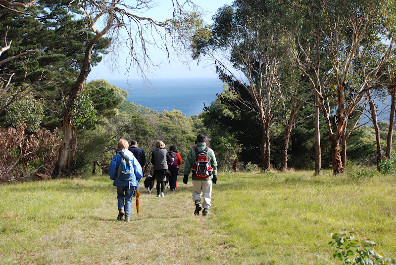
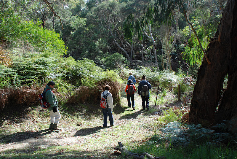
The track that leads to Eskdale Spur follows the course of Mountain Creek and crosses it several times. The first crossing was easy enough,


and the second was a bit trickier!


However, the third and fourth crossing proved to be a rather dampening experience.

In drought, this creek would be a mere trickle but with recent rain, the creek was flowing well. But it could have been worse, only a few weeks before, this area of Victoria had seen record rainfalls and I am sure there creek would have been a raging torrent and quite dangerous to cross.


So without further ado, I waded through the creek and kept on walking.


It wasn't too long before I was at the base of steep climb that would take me to the saddle where the track leading up Eskdale Spur begins.

Okay, up until now, I thought I was making good progress over the gradual inclining terrain.

The drop down to Mountain Creek track.

But by the time I got to the top of this track, I knew it was only going to get steeper. I had been charging along to make sure I had enough daylight hours to reach the summit and make camp at Cleve Cole Hut. I had walked the 7 kms to this point in about 1.5 hours and with only 4 kms to the summit, I decided I still had plenty of time.

After changing my thoroughly saturated socks, I ate lunch whilst watching a large group of bush walkers arrive in their cars and prepare to walk up the short distance to the summit.
I was hoping to set off before them but my rapidly stiffening leg muscles were telling me otherwise. So I decided to let them go ahead to avoid being passed by each of them further up the track.


Lunchtime views

As the group set off up the Summit track, they inquired into my intentions. I explained my plans as I took their photo on various cameras and phones, to which they replied they were spending the night on the Summit to prepare for checkpoint duties they were undertaking in the morning for the Conquestathon. I was then informed, about 180 people were going to ascend Mount Bogong in the morning via the Staircase Spur and race across the top and down Eskdale Spur and back to Mountain Creek camp ground. Arrgh! So much for a peaceful hike up Mount Bogong.


Eskdale Spur Track


With the concerning thought of having to dodge 180 people as they raced up Staircase Spur and stiffening legs and quietly creaking hips, I set off up the track to the Summit.


However, I then thought, its only 4 kilometers, I will be there in no time!


Mount Bogong through a veil of silver branches.


Okay, I wasn't going to tell anyone this, except my base camp support person,
but I will say it here, it took me 2 hours to walk the the next 2 kilmoters the Michell Hut!

I know, what can I say, the tracks to the summit of Mount Bogong are very steep and with an extra 12+ kilos on my back, they are even steeper!

Mind you, I met half of the group that were ahead of me at Michell Hut and they had driven to the base of Eskdale Spur and it took them just as long. So I reckon I did alright after walking an extra 7 kms that were uphill all the way.


Michell Hut

At this point, I decided that discretion was the better part of valour and that Michell Hut would make a nice overnight camping spot!


New tent with green socks!


I waited for the group to head off, so they wouldn't see me waddling around the hut as my hips were stuck in carrying heavy bag mode, as I set up my tent.

This is a new tent for me and weighs about 1 kilogram. There must have been a rock in my pack but I couldn't find it!

It didn't take long to set up camp and after a short while, my legs and hips came good. So I decided that with plenty of daylight left, I would walk to the Summit and make it back down before dark. I put bottles of water, muesli bars, warm clothes and my raincoat back into my pack and set off to the summit. 


With a much lighter pack, I made good time up the last 2 kilometers to the Summit.


View of Mount Bogong with pole.


It was a steep track and rocky under foot in parts.


Once I was above the tree line,


View of Mount Bogong without pole

there were excellent views into the valleys below.


Don't trip here...it's a long way down!

Landscape views often don't reveal just how steep the terrain is,


so here are couple of portrait views of the path.


Well three actually.


Nearly there!


It wasn't too long before I was looking into the valleys and mountains on the other side of Mount Bogong.


I glanced to my right and there was the Summit!


I looked behind me and saw that the cloud cover was starting to obscure 
the path back down.


So I quickly took a few more photos,


and set off on the last 500 meters to the Summit.


Cloud track


A wave of elation and great satisfaction arose in my chest (or was that altitude sickness?!) as I walked up and touched the very large summit cairn. I made it!


Mount Bogong Summit Cairn and pack.

I wandered around the Summit, taking in the views, fresh mountain air
 and a few more photos.


Mount Feathertop is grey lump on the far right.


The group ahead of me were already well set up for the evening
and were enjoying prime views with their choice of camp location.


View down Staircase Spur

All too soon, it was time to head back down to my tent awaiting me at Michell Hut.


Sunlight on Eskdale Spur


The setting sun seemed to make the ridges of the mountain side glow.


It was difficult to concentrate to look at where I was placing my feet with such
beautiful scenery in the fading light.


But I did,


and made it back to camp as the last glow of sunset reflected
onto the side of Michell Hut.


I ate my gourmet dehydrated camping risotto as the full moon rose
and cast an eerie glow through the silver branches of the snow gums.

It was so quiet and peaceful. I was soon warm, snug and sound asleep
in my new tent on the side of Mount Bogong.


Morning views.


At some unruly hour of the morning, with the sun barely up, I heard what sounded like pounding footsteps rushing towards me! With great alarm, I stuck my head out of the tent and saw what could be described and a large spider dashing down the track from the Summit of Mount Bogong. As I rubbed the sleep out of my eyes, a man with ski poles in either hand, ran past my camp site and with a quick 'Good Morning',
disappeared out of sight down Eskdale Spur.

The Conquestathon had arrived!

By the time I had breakfast and packed up camp, a further 5 competitors had passed me.
By the time I made down Eskdale Spur, which wasn't very long, a further 6 competitors ran past.

It is amazing just how fit some people are!


Morning sunlight over Mount Bogong.


As I sat waiting for my ride, many competitors passed through the near-by check point.
The next time I walk to summit Mount Bogong, (there will be a next time) I will be much fitter but I certainly wont be running.


I've been there!

... and I will be back!


Hope you enjoyed the ramblings of one Walkabouter's adventure on Mount Bogong.


Walkabouters Club of Victoria Inc.
A0019863A
Related Posts Plugin for WordPress, Blogger...