On another perfect Melbourne's winter day, 11 Walkabouters met at the Darebin Parklands for an enjoyable 15 kilometer walk following the Darebin Creek Trail.

The catchment of the Darebin Creek begins north of Melbourne past the town of Woodstock and flows through the town Wollert and the suburbs of Epping, Bundoora, Ivanhoe and meets up with the Yarra River at Alphington.

Walking was easy, following the bitumen and concrete track that is shared by cyclist, walkers, runners, dogs walkers and the local snake populations.

The land that now makes up the Darebin Creek Trail and Parklands was the original home of the Wurundjeri clan of the Woiwurrung people.

We headed north, following the Darebin Creek upstream,

in the glorious, morning sunlight.

These Currawongs kept a beading eye on us as we walked on by.

You wouldn't know it, but suburbia is just a stones throw away.

Over the last one hundred years or so, the land surrounding Darebin Creek has had many uses including dairy farming, market gardens and fruit orchards. Agriculture eventually gave way to expanding suburbs and industry.

Geology has also had a major influence on the development of the land. The eastern side of Darebin Creek is dominated by ancient sedimetary sandstone laid down during the Silurian period.
On the western side of the Creek, the land forms are predominately volcanic-based quaternary basalt created from lava flowing from volcanoes to the north of Melbourne about 800, 000 years ago. Hence, quarrying for bluestone was very popular on the western side of Darebin Creek.

Darebin Creek is a natural divider of the two geological areas.
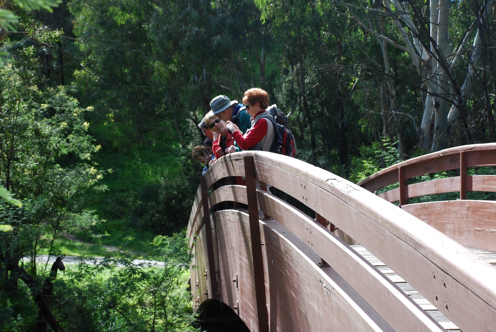 | ||||
| Pooh sticks anyone? |
We crossed the creek on several occasions. This bridge provided a great vantage point views, photos and childhood games.
 |
| Looking up stream from the bridge |
Along the trail, there are notices and signs to keep walkers from getting lost and getting entangled with cyclist. It's important to keep left!

The morning winter light provided some good photo opportunities.
 |
| Reflecting |
 |
| on reflections. |
 |
| Sunlight through Black Wattle |
Along the banks of the Creek we saw the signs of European influences,
 |
| Willow |
as well as impressions of modern living.
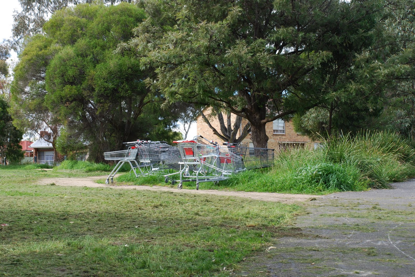 |
| Trollei collectus |
Local friends groups and the Council have undertaken lots of regeneration and revegetation along the banks of Darebin Creek and surrounding parklands.
 |
| A more natural setting. |
We arrived at our morning tea spot and enjoyed the views over the creek towards the west whilst sipping on our water and nibbling our snacks.
 |
| Just up from Northland...no lattes for these intrepid Walkabouters! |
After our morning tea,

we headed downstream aiming to return to Darebin Parklands for lunch.
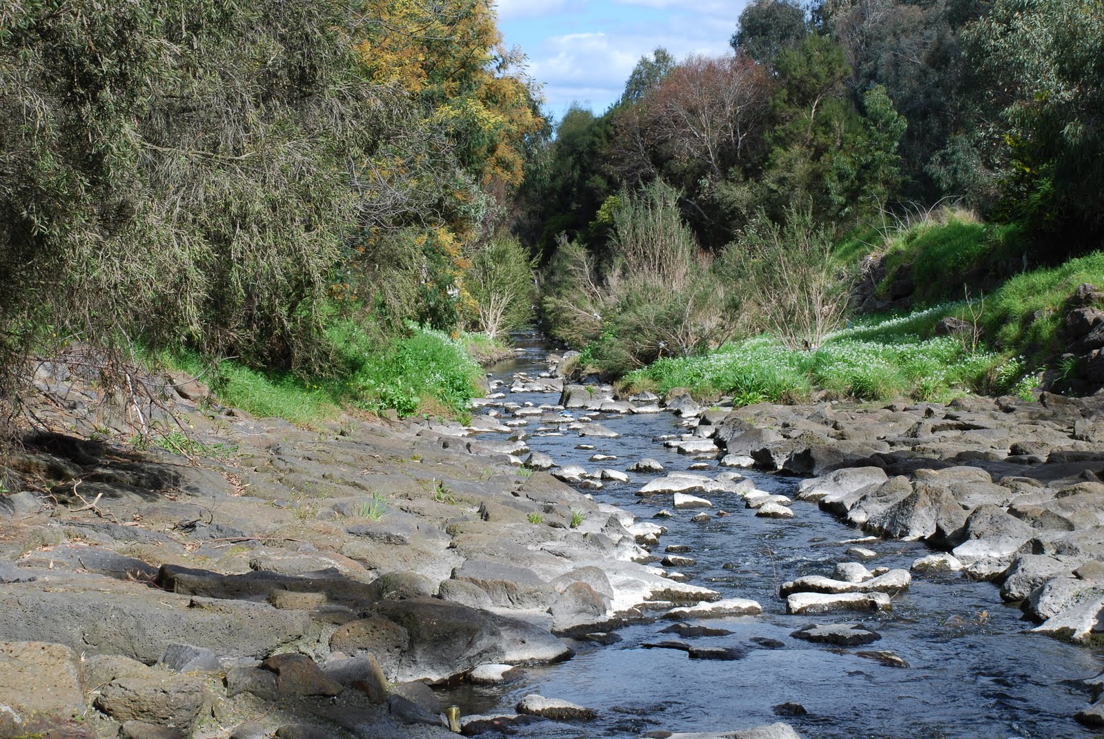 |
| Looking downstream towards Melbourne. |
So back down the trail we went,

making sure to keep left,

back over the bridge,

whilst enjoying the views,

and under bridges,
 |
| Locally quarried bluestone reinforcing the creek banks. |
following the Creek,
 |
| Acacia verticillata Prickly Moses |
until we arrived back at Darebin Parklands,

but where is everyone?

lost again?!
aahh....

there they are!
Thank-you to our intrepid leader for an excellent day's walk.
For more information about Darebin Parklands click on the following links
Walkabouters Club of Victoria Inc.
A0019863A
Fabulous photos of one of our urban creeks. I love the shopping trolley art installation too.
ReplyDeleteHello Hazel, thanks for dropping by and the nice comments about the photos. Yes, we enjoyed the art installation as well. However, the nearby water and trolley piece didn't quite catch the morning light so well. It was a lovely walk.
ReplyDeleteWV.