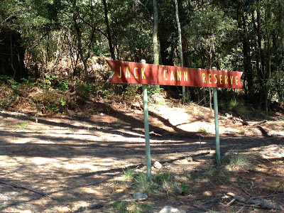
On this chilly Spring morning nine Walkabouters met at the Jack Cann Reserve in Blackwood. Our plan was to complete the 9 km Lerderderg Heritage River Walk.
After hoisting our packs onto our shoulders and brief introduction to the area, we set off at a leisurely pace along the walking track through this landscape of heritage significance.
Blackwood is a small town located 89 kms northwest of Melbourne and is situated on the Lerderderg River. The town was founded in 1855 during the Victorian Gold Rush. The area surrounding the River was mined extensively in the search for gold by thousands of prospectors looking to make their fortunes.
The Lerderderg River was classified as a Heritage River in 1992 due to
geological and geomorphological formations of State and International
significance.
Evidence of the gold mining activities with many tailing heaps, man-made water courses and mine shafts were clearly visible throughout the forest. Leaving the track requires great caution as a missed step could be greater than expected.
This mine shaft was certainly very deep and had filled with rain water.
Blackened tree trunks from recent bush fires dotted the landscape
and provided a dramatic contrast with the fresh green grass from Spring growth.
Amongst the grasses we were able to spot wild flowers in abundance.
The following photos show a few of the many flowers that we saw.
 |
| A Milk Maid |
 |
| A Bearded orchid |
 |
| A Grevillea |
 |
| A cluster of Bird Orchids |
 |
| A Trigger Plant |
Here we are looking up and down at the vegetation all around.
In this north-western part of the Lerderderg Hertitage River corridor, the vegetation
consists mainly of tall damp messmate-peppermint gum forests.
There over 320 different species of native flora to be found in the L. Heritage River corridor.
Eleven of these species are considered to be rare or threatened to become extinct in Victoria. Careful management of this area is needed to keep these species protected to ensure bio-diversity of this unique ecological habitat for the future.
The Lederderg Gorge was created about 1 million years ago as a result of uplifting
along the Rowsley fault caused down-cutting of the Lerderderg River.
It wasn't long before we had excellent views down into the River from
the tops of the steep slopes.
You can just see down on the right.
Or just look at the next photo for a better view!
 |
| Lerderderg River |
We walked past an excellent example of the steep rocky cliffs created by all that
geological uplifting and down-cutting. I am glad I wasn't there at the time!
Lunch was had on the River banks next to an old damn that was built by an enterprising woman during the gold rush.
The walls were created by placing logs vertically side by side cutting
off the flow of the river. Water was then able to be sold and released
to prospectors to wash mounds of freshly dug dirt hoping to reveal specks and maybe nuggets of gold.
 |
| View downstream |
A water race was dug that followed the course of the River. This allowed water to be released from the damn to then be diverted to individual claims.
We were soon on the move again after finishing our sandwiches, fruit
and curry with yogurt.
We followed the River walking along the remains of the water race.
And it wasn't too long
before we were back to where we started...
the Jack Cann Reserve which is right next door the the Garden of St Erth.
A perfect place to finish our last walk for the year!
I'm already looking forward to walking next year!
If you are interested in joining us or
would like more information about any of our walks
please send an email to:
walkabouters@hotmail.com


