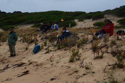
As the grey clouds rolled, 10 Walkabouters set out to walk along
the Bass Coastal Trail.
the Bass Coastal Trail.
The George Bass Coastal Trail is situated 120 kms south east of Melbourne and stretches from the outskirts of San Remo to the township of Kilcunda.
The trail starts at Punchbowl Reserve, so named for the crater like rock formation at the base of the cliffs. Looking down we saw two fisherman standing on the rocks. As we watched a large wave crashed over the rocks, knocking the men off their feet. They were soon back on their feet fishing again!! People have drowned after being swept off these rocks. The fisherman were testing their luck!
The trail follows reserves of land sandwiched between the cliffs and farmland. Remnant native vegetation can still be found clinging to the cliff tops including Coastal Banksia, Coastal Beard Heath, white correa and coastal tea-tree.
So who was George Bass?
 |
| Half Moon Bay |
Here are a few words about George to go with the dramatic coastal views.
George Bass was a surgeon in the British Royal Navy and arrived in the young colony of Sydney Cove in Port Jackson, New South Wales, in 1795 on board HMS Reliance.
He brought with him a small wooden row boat nicknamed "Tom Thumb". George and his fellow ship mates Matthew Flinders and William Martin went exploring along the coast of New South Wales towards Botany Bay in search of good grazing land, fresh water sources and safe harbours, as well as creating navigational maps of the coastline.
In 1797, George and six crew members rowed a whale boat south along the coast towards Van Diemens Land. At the time it was thought that Van Diemens Land was attached to the rest of Australia. George and his crew rowed to the furthest south eastern point of Australia Cape Howe and then west along the of Gippsland and into Western Port Bay.
Through his observations and knowledge of tides and swells, George
concluded
that a strait existed between Australia and Van Dieman's Land.
He later confirmed this on a voyage of exploration with Matthew Flinders in the
sloop Norfolk by circumnavigating Van Diemans Land.
that a strait existed between Australia and Van Dieman's Land.
He later confirmed this on a voyage of exploration with Matthew Flinders in the
sloop Norfolk by circumnavigating Van Diemans Land.
Whilst he was rowing along the Gippsland coast, George landed not far from the
coastal trail to replenish his water supply.
The small town of Bass was named in commemoration of his landing.
coastal trail to replenish his water supply.
The small town of Bass was named in commemoration of his landing.
So, the next time you travel to Van Dieman's Land (Tasmania) by boat,
you will know who the Strait is named after.
And you will want to hope for a smooth crossing of Bass Strait.
We ate lunch sitting on the beach and watched the waves crash
as they rolled in from Bass Strait.
 |
| Lunch time |
And then the sun set.


Looks like a wonderful walk along our beautiful coastline. Sorry I missed it but I didn't need a coat or beanie where I was yesterday!
ReplyDeleteHDW
This comment has been removed by a blog administrator.
ReplyDeleteIt is a beautiful coastline. I am glad you kept dry yesterday. You missed out on another example of why you should carry a dry set of clothes in your pack!
ReplyDelete