Saturday, August 6, 2011

Blackburn Lake to Laburnum, Saturday 6th August.

After a week of unseasonably warm weather, we were hoping for another fine and warm day for our 10 km walk through Blackburn Lake and the adjacent Creeklands to Laburnum. Unfortunately, the forecast was for a change of weather with potential thunder storms, high winds and the chance of snow in the Alpine Regions.


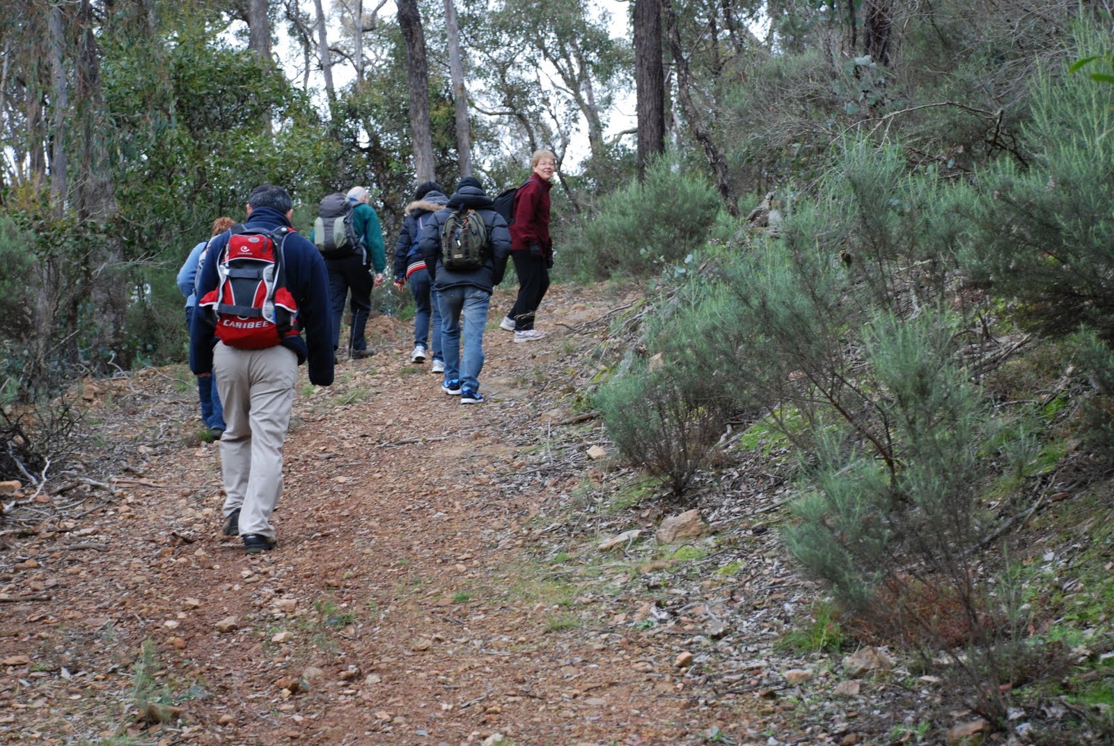
Despite the dismal forecast, 12 Walkabouters met in the car park of Blackburn Lake Sanctuary with great enthusiasm, ready for our day's walk.


Ensuring that we had our wet weather gear in our packs and woolly hats and gloves at the ready, we headed off to follow the meandering tracks around the Lake.


Blackburn Lake Sanctuary is nestled in Melbourne's eastern suburb of Blackburn less than 18 kms from the CBD. The Lake was formed by the damning of Gardiner's Creek in 1889. An investment group which owned the land at the time, wished to make a reservoir to supply water to local orchards and to enhance land values in the local area.


In the 1890's, Blackburn Lake was a popular destination for day trips and picnic excursions by a 2 hour steam train ride from Melbourne.


The Lake has a number of wooden landings that provide excellent access to views across the water and duck feeding.

As the day was overcast, photos of views across the Lake did not do it justice today.   


So here is one that was prepared earlier.


The Lake can really look very picturesque and tranquil.


Look! Up in the sky! Is it a bird...is it a plane?

We continued along the paths on the lookout for birds, wild life and flowering native plants,


 ...No! It's 2 birds with brightly coloured feathers. (Tourists from Queensland)

 as we crossed some bridges,


and caught some glimpses of the Lake,


and views to the shore on the other side.


We wandered along the footpath next to the Lake's retaining wall for a short distance before entering the Sanctuary again to have morning tea by the southern shore.


A refreshment room and jetty once stood not far from our morning tea spot. 
Row boats were available for hired for adventurous picnickers.  


Watersports including yachting, speed-boating and water-skiing were prevalent right up to the 1960's. The Lake was declared a Sanctuary in 1965 and during the 1970's and 1980'serious plans and efforts were made to repair and regenerate the lake and bushland.


Well known Australian painter, Frederick McCubbin lived in the area in 1893 and painted some of his most well known works including "The Bush Burial" and "Down on His Luck" in the surrounding bushland close to Blackburn Lake. 

Leaving the Lake behind, we crossed briefly into the suburbs that surround the bushland sanctuary and joined the paths that follow Gardiners Creek.


The wattles were flowering gloriously,


 and the air was filled with their perfume 


 and the water glinted with a film of pollen deposited by the wind.


What a fun guy!

Our intrepid leader pointed out some fungi and then lead us to a nearby coffee shop to enjoy cups of tea with our home made sandwiches.

A big oak tree by the oval.

On the way back we walked past some interesting trees,


 and enjoyed the rewards of tree planting and re-vegetation that has been undertaken over the year along the natural waterways.


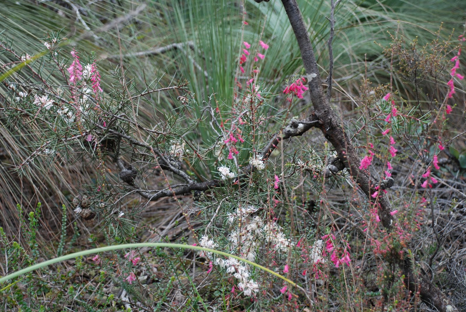
To finish with, here are a few photo of plants that were flowering
in the bushland around the Lake.

Acacia paradoxa  Kangaroo Thorn


Hardenbergia violacea  Happy Wanderer


Hakea decurrens  Bushy Needlewood


Spyridium parvifolium  Dusty Miller


Clematis microphylla  Small-leafed Clematis

We arrived back at the cars just as the thunder started to rumble, and rain slightly damped our cups of tea. The walk was about 9.5 kms in length and was easy walking with wide, even  paths.  There were many opportunities for botanising and birdwatching and for much of the walk, you wouldn't even know you were walking through a major city!


A great days walk!


Click on the link for more information about
 Blackburn Lake Sanctuary  


Next walk is Saturday 27th August - Darebin Creek Trail


Walkabouters Club of Victoria Inc.
A0019863A

Monday, August 1, 2011

Walk Notice - Blackburn Lake to Box Hill - Saturday, 6th August.

The Walk:

We start by walking around beautiful Blackburn Lake on some nature trails. Then follow Gardiners Creek to south of Box Hill area; there are bridges and parks to explore. We will return the same way with an alternative track around the Lake.

Grade:

Easy 10 km.


Come walk with us.


Walkabouters Club of Victoria Inc.
A0019863A

Sunday, July 17, 2011

Sapling Gully - Sunday, 17th July

It's a tradition with the Walkabouters to allow plenty of time prior to the commencement of the walk. This allows time for navigation issues in new areas and for stragglers to arrive in time. It also lets early arrivals to have an extra cuppa before heading off.

Due to recent mishaps with arriving on time to walks in the Brisbane Ranges, the meeting point was in Bacchus Marsh and extra early to allow for car pooling and prevent anyone from getting lost. This tactic worked well!


With only a few kilometres to drive, from Bacchus Marsh, it wasn't long before we arrived at the start of the walk - Sapling Gully Picnic Area.

Sapling Gully is in the northern end of the Brisbane Ranges, which is 80 kms west of Melbourne. Sapling Gully is a very rocky creek bed that runs in a fairly north-south direction between the hills, and the picnic area is lies between two steep, rocky hills adjacent to the gully. In heavy rain this gully would rapidly fill with water running off from the hills, quickly becoming a raging torrent.


We started our walk, heading up Red Ironbark Track, following the ridge line toward the summit of the mountain. Our first steep incline of the day!


Red Ironbark Tree


The track crossed a tributary of Sapling Gully, which showed recent evidence of the recent floods. A lot of debris lay strewn along it's path.


 After a few initial undulations to warm us up, we commenced the steep part of the incline!


Fortunately, there were many interesting botanical observations to be made on this ascent which allowed everyone to catch their breath without anyone noticing!


Due to the recent rains, the vegetation was very lush and green. Moss was growing prolifically on the lower slopes, providing a patchwork of every possible shade of green.


There were even some tiny fungi growing amongst the moss.


As we gained altitude the moss gave way to lichen and the bushy undergrowth became more sparse.


Shortly before reaching the summit we started to encounter the odd Grass-tree here and there.


It wasn't long before we were surrounded by them!


Upon reaching the summit of the ridge, we took a few moments to indulge in some botanising.


Unfortunately, we didn't see a single orchid. Maybe it was a bit early in the season.


And then we headed down hill, toward our lunch destination.


This cave looked the perfect place for a yeti to hide, or maybe a black panther!


We took a right turn at Glider Track,


 and followed the meandering path,


 between the Eucalypts,


past a sudden drop,


through an open space,


and after a quick consultation with the trusty GPS, we arrived at our designated lunch spot.


WP - Walkabouter's Picnic

We knew it was our lunch spot because the sign in the background said so!


The Water Point looked just like the place a bunyip would live.


After lunch we headed back along Loop Track,  


past trees that were regenerating after recent fires.


We stopped to say hello to the friendly Parks Ranger,


before finding Pea Track and disappeared into it.


A brief stop to quench our thirst and to listen to a story about an aeroplane that crashed landed near here.


We quickened our pace, after the brief rest, as the temperature was became considerably colder, as a south-westerly breeze sprang up, ahead of the forecasted rain. 


After a trudge along an ascending 4WD track, we arrived back at Sapling Gully Picnic Area.


Five Walkabouters and two guests enjoyed this winter's walk through the northern part of the Brisbane Ranges. We walked 13.5 kms in total and climbed 140 metres up Red Ironbark Track to the summit of the ridge. 

Hot cups of tea and biscuits were a welcomed reward after a good days walk!


For more information, the Friends of the Brisbane Ranges  have a very informative website 
about the flora, fauna and geology of the area.

Parks Victoria also have information on tracks and walks in the area. 
See the link on the side bar to visit the website


Walkabouters Club of Victoria Inc.
A0019863A

Tuesday, July 12, 2011

Walk Notice - Brisbane Ranges – Sapling Gully - Sunday, 17th July

Grade:

Medium walking with some ups and downs, about 13 km in length.

The Walk:

This is a circular walk from the Sapling Gully Picnic Area. We should see the early spring wild-flowers and some grass-trees.


Here is a question to ponder until the walk. 

What would make an interesting collective noun for a group of Grass-trees?


Grass-tree or Xanthorrhoea spp.


If you are interested in joining us on the walk,
contact us by email for details.

 walkabouters@hotmail.com


Walkabouters Club of Victoria Inc.
A0019863A
Related Posts Plugin for WordPress, Blogger...